
This is a map of the city of Bell in the East Los Angeles region. I retrieved this map from the city of Bell's official website. This map is specific in showing all the streets and how they connect. This map shows communication taking place at the scale of city. The map shows the legibility of this city in the organization of the streets. There is uniformity in how the streets and avenues run. Also, this map is a good example of a nominal location. I also think this map is interesting because it shows an outsider how to navigate in the city (a person who lives in the city might find a map with landmarks more relevant to his/her needs).

This is a map of the Los Angeles freeways and airports. I took this map from an internet tours website (inetours.com). My interest in this map focuses on the freeways. I see that the freeway system is an intense web of communication at the scale of counties (as opposed to my next map which represents communication at an international scale). I also think this map is interesting because in case of an emergency it is a resource for orientation and also an evacuation plan. Even though the freeways in Los Angeles are more often than not traffic jammed, they create easier routes which are taken to get to Los Angeles from other nearby counties.
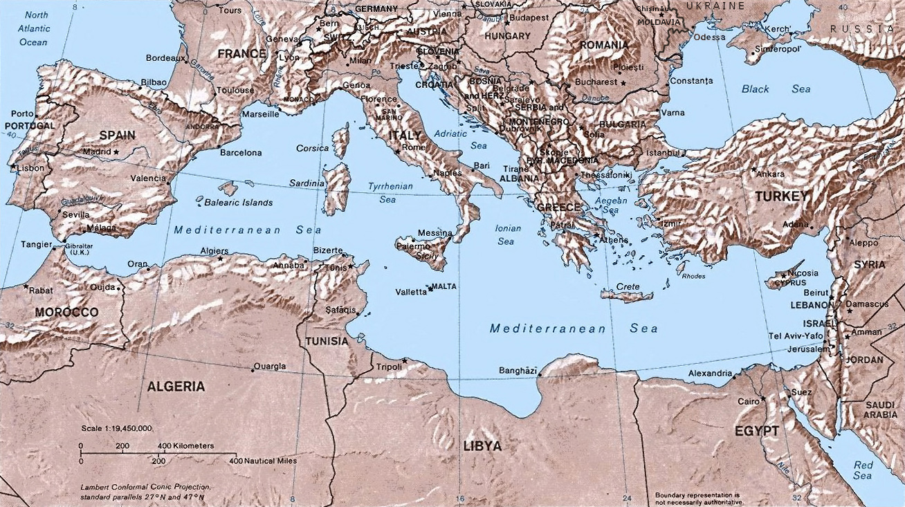
This is a map of the Mediterranean sea and the land masses surrounding it. The Wikipedia website is online source from which I retrieved this image. The map shows the Mediterranean sea as its center with the European, African, and Asian continents surrounding it. I find this map interesting because it shows many possible paths of communication in terms of sea navigation for three different continents. Furthermore, it represents the complex political and economic interactions between the three continents. I also find this map interesting because it shows the connection of the Mediterranean sea to the Atlantic sea (many consider the Mediterranean sea as its own body of water).
 This is a map of the city of Bell in the East Los Angeles region. I retrieved this map from the city of Bell's official website. This map is specific in showing all the streets and how they connect. This map shows communication taking place at the scale of city. The map shows the legibility of this city in the organization of the streets. There is uniformity in how the streets and avenues run. Also, this map is a good example of a nominal location. I also think this map is interesting because it shows an outsider how to navigate in the city (a person who lives in the city might find a map with landmarks more relevant to his/her needs).
 This is a map of the Los Angeles freeways and airports. I took this map from an internet tours website (inetours.com). My interest in this map focuses on the freeways. I see that the freeway system is an intense web of communication at the scale of counties (as opposed to my next map which represents communication at an international scale). I also think this map is interesting because in case of an emergency it is a resource for orientation and also an evacuation plan. Even though the freeways in Los Angeles are more often than not traffic jammed, they create easier routes which are taken to get to Los Angeles from other nearby counties.