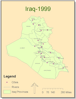
I had some trouble with being able to clearly separate the province and city names. ArcMap continued to give me an error message about the map units. Overseeing this minor detail however, the digitizing was relatively easy and straight forward. I liked having to figure out some of the operations by just experimenting and some by getting help from classmates. I had trouble with the function of cutting the polygon which was necessary to make the provinces; I had overlooked the fact that my overall tracing of the Iraq map had to be selected in order to do proper snapping. I believe this lab was very instructive and that it is also very useful in common practice.
No comments:
Post a Comment